Collections
Organize raster and vector data, set privacy and share access with your organization.

LGM Platform · Control plane
One account for collections, organizations, credentials and usage across LGM GIS, API, MCP and plugins.
Product interface
See active applications, manage collections and understand how each key consumes requests, tokens and compute.
See how usage is measured →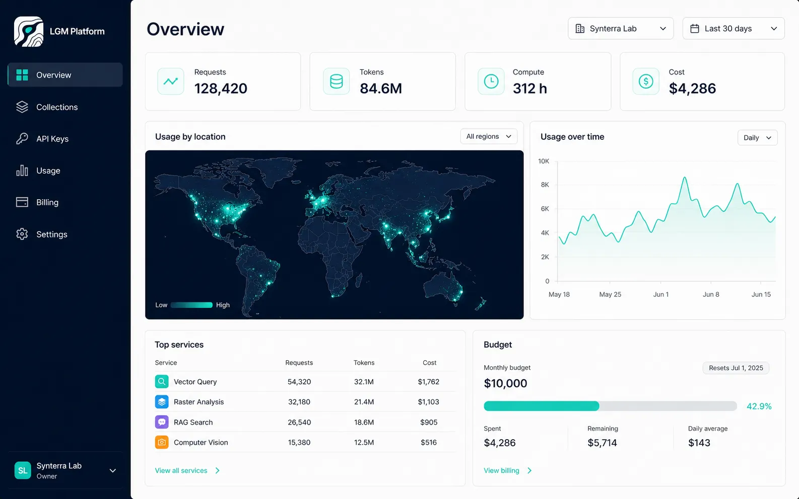
First five minutes
A short path from creating a workspace to observing production usage.
Choose raster, vector or imagery data.
Upload private assets or connect an available source.
Grant only the services an application needs.
Use one credential across the selected interfaces.
Review requests, tokens, compute, limits and cost attribution.
Platform modules
The operational layer shared by browser, agent, API and plugin workflows.
Organize raster and vector data, set privacy and share access with your organization.
Use OAuth 2.0, OpenID Connect, SAML, MFA and passkeys through a self-hosted identity layer.
Issue and revoke keys for individual services, applications and environments.
Attribute requests, tokens and compute to an account, organization and API key.
Set client budgets and usage limits before workloads reach production scale.
A foundation for future distribution of datasets and geospatial assets.
Security foundation
LGM uses a self-hosted identity layer, supports enterprise identity providers and keeps an audit trail of authentication and security events.
Platform access